Projects
Fort St. James Forest District Archaeological Predictive Model Revision Project
Services: Archaeology & Cultural Resources, Geographic Information System (GIS)

Work Involved:
- Geographic Information System (GIS)
- Archaeological Predictive Modelling
- Archaeological Overview Assessment (AOA)
- Traditional Land Use (TLU) Study
- Traditional and Ecological Knowledge Study (TEK)
- Cultural Heritage Inventory
- Ethnographic Research
- First Nations and Indigenous Consultation
- Project Description:
An archaeological predictive model for the Fort St. James Forest District was originally created by Norcan Consulting Ltd. in 1999. The model was created with funding with the Ministry of Forests to aid development planning in the district.
Ecofor received Forest Investment Account (FIA) funding through Canadian Forest Products to assess and upgrade the model into a GIS-based system. Ecofor proposed and executed a multi-phase project.
Phase I involved consultation with First Nations within the district to collect ethnographic and traditional use data.
In Phase II a cultural heritage resource inventory database was created and the Norcan model was statistically analyzed.
Phase III of the project proposed field testing for the model; however, due to time and budget constraints, field testing did not occur.
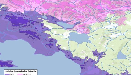
In Phase IV, development and assessment of the newly created GIS-based predictive model for the Fort St. James Forest District took place. The GIS-based model focused on the actual landscapes where previously recorded sites and how they pattern, in an effort to minimize bias from modern perspectives of the land and topography.
Phase I, II, and IV of the project occurred in 2003-2004. The updated model was approved by the BC Archaeology Branch and implemented for development planning use in the district in 2004. Updates to the inventory database occurred in 2007 and 2009. Ecofor conducted a comprehensive review of the model in 2009, with a recommendation for field testing and further updates.

